Revitalizing Hochelaga-Maisonneuve
BACKGROUND AND CONTEXT
Project Information
Objectives
- Conducted GIS-based mapping and spatial analysis
- Created slope feasibility graphs and transit network evaluations
- Designed land use, green infrastructure, and density plans
- Developed diagrammatic 3D visualizations illustrating the proposed redevelopment strategy
- Proposed alternative tram alignment and tunnel segment
- Integrated climate vulnerability and transit equity analysis
Background
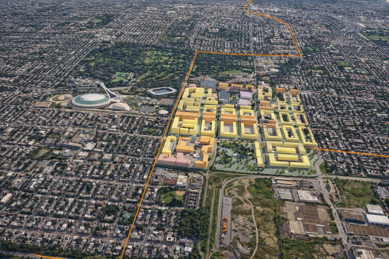
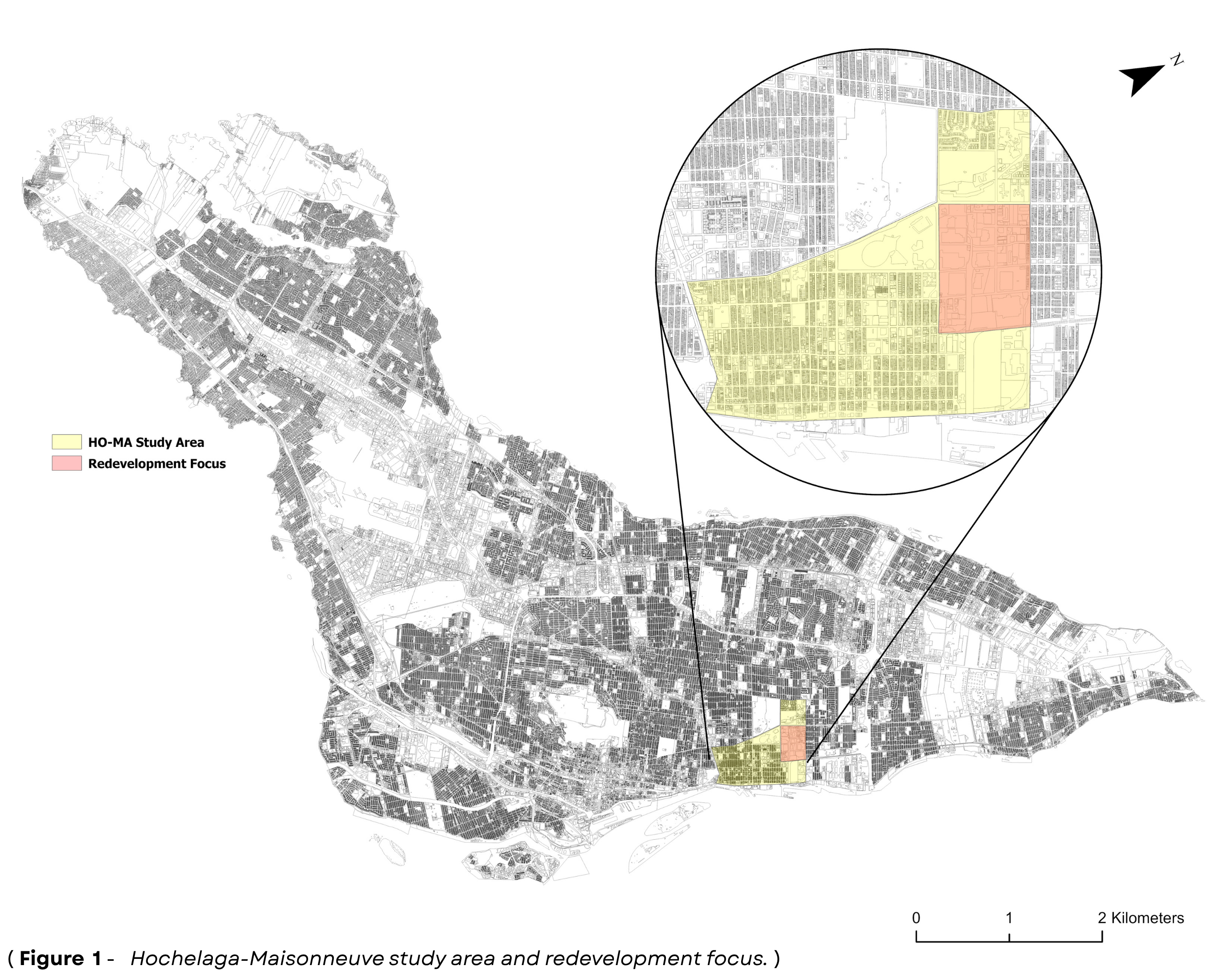
Hochelaga-Maisonneuve, a historically industrial neighbourhood in eastern Montreal, has long been shaped by its proximity to the Port and its role in manufacturing and logistics. Following decades of deindustrialization, the area now faces challenges related to underutilized land, brownfield contamination, and fragmented urban form. Despite its decline, Hochelaga-Maisonneuve remains rich in cultural identity and is strategically located near key civic anchors such as the Olympic Stadium and Botanical Garden. This project focused on a 42-hectare redevelopment zone within the neighbourhood, characterized by large industrial parcels, limited green space, and poor transit access. The objective was to reimagine this area as a sustainable, high density, mixed-use district that reconnects with the surrounding urban fabric. Special emphasis was placed on enhancing transit coverage through a new tram line, integrating climate-adaptive infrastructure, and transforming the legacy street grid to support walkability, ecological resilience, and inclusive urban living.
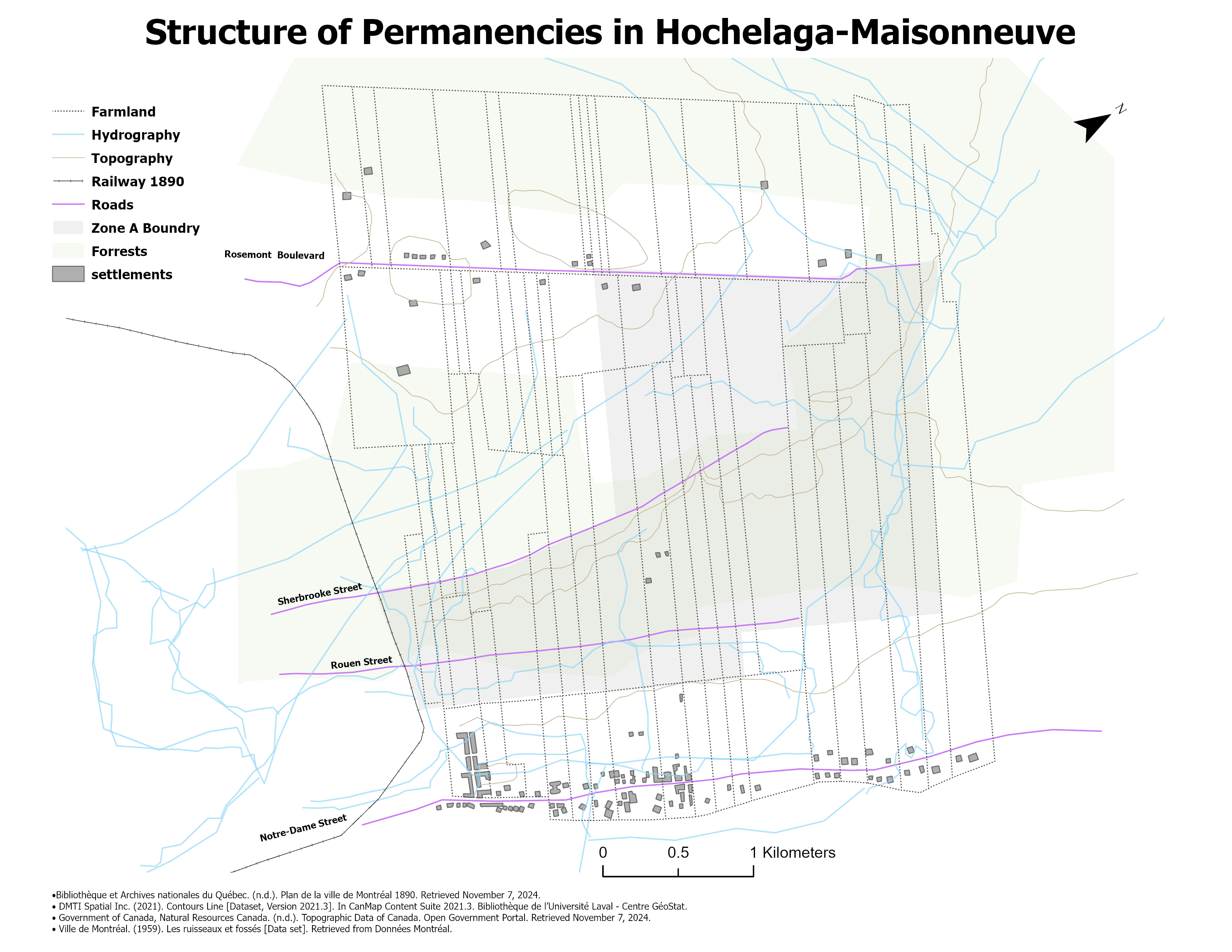
History & Ecology
-
The analysis focused on environmental sustainability, with historical context as a secondary lens.
-
Early development followed Notre-Dame Street, shaping the area’s initial urban form.
-
The site evolved from farmland to industrial use, including factories and rail.
-
Uneven terrain and wooded remnants reflect its layered ecological history.
-
Urbanization led to the loss of historic streams, increasing flood risk.
-
This presents an opportunity for green infrastructure and stormwater management.
-
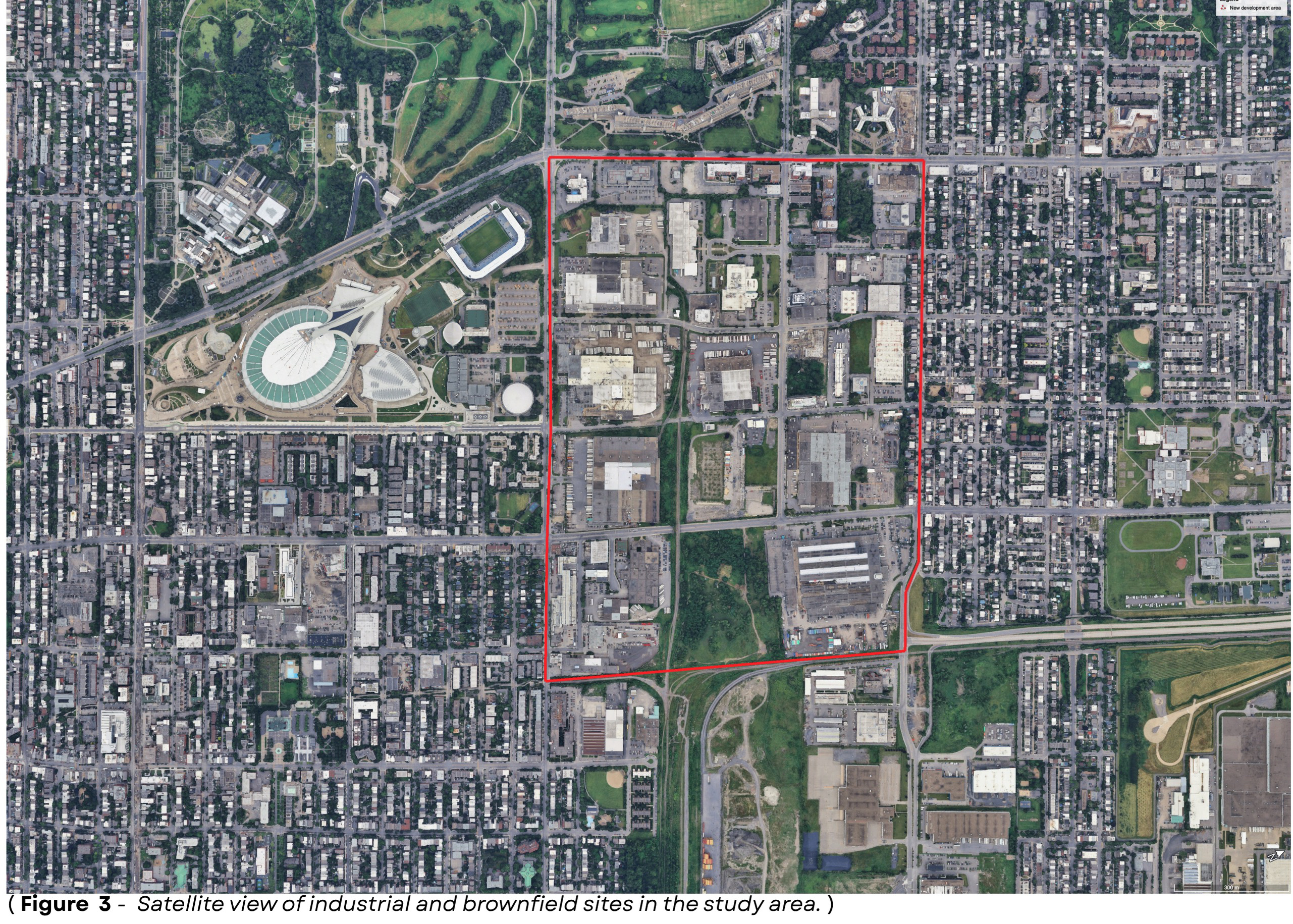
Satellite imagery reveals large, underused plots with minimal vegetation, highlighting the extent of brownfield and industrial land.
-
The area includes storage facilities, manufacturers, and distributors—such as Pom bakery and Coca-Cola—linked to Port activity.
-
These parcels offer major redevelopment potential, combining land reuse with environmental remediation.
-
The site’s industrial concentration and ecological disruption reflect its legacy and underscore the need for reintegration.
Redevelopment Vision
-
Redevelopment Opportunity: Transform a brownfield- heavy, industrial area into a vibrant, mixed-use neighbourhood.
-
Urban Integration: Extend the existing Hochelaga- Maisonneuve urban fabric through cohesive planning and design.
-
Regional Destination: Establish the area as a new urban hub serving both local residents and the Greater Montreal Area.
-
Anchor Institutions: Leverage proximity to the Olympic Stadium, Stade Saputo, and Botanical Gardens as catalysts for activity.
-
Transit-Oriented Development: Introduce a new tram line to improve site access, strengthen connectivity, and support higher-density uses.
-
Complete Community: Enable a livable district where people can live, work, and enjoy public and recreational spaces.
-
Year-Round Activation: Encourage longer visits by event-goers through dining, public space, and cultural programming.
-
Long-Term Goal: Position the area as a standalone destination, not just an extension of nearby landmarks.
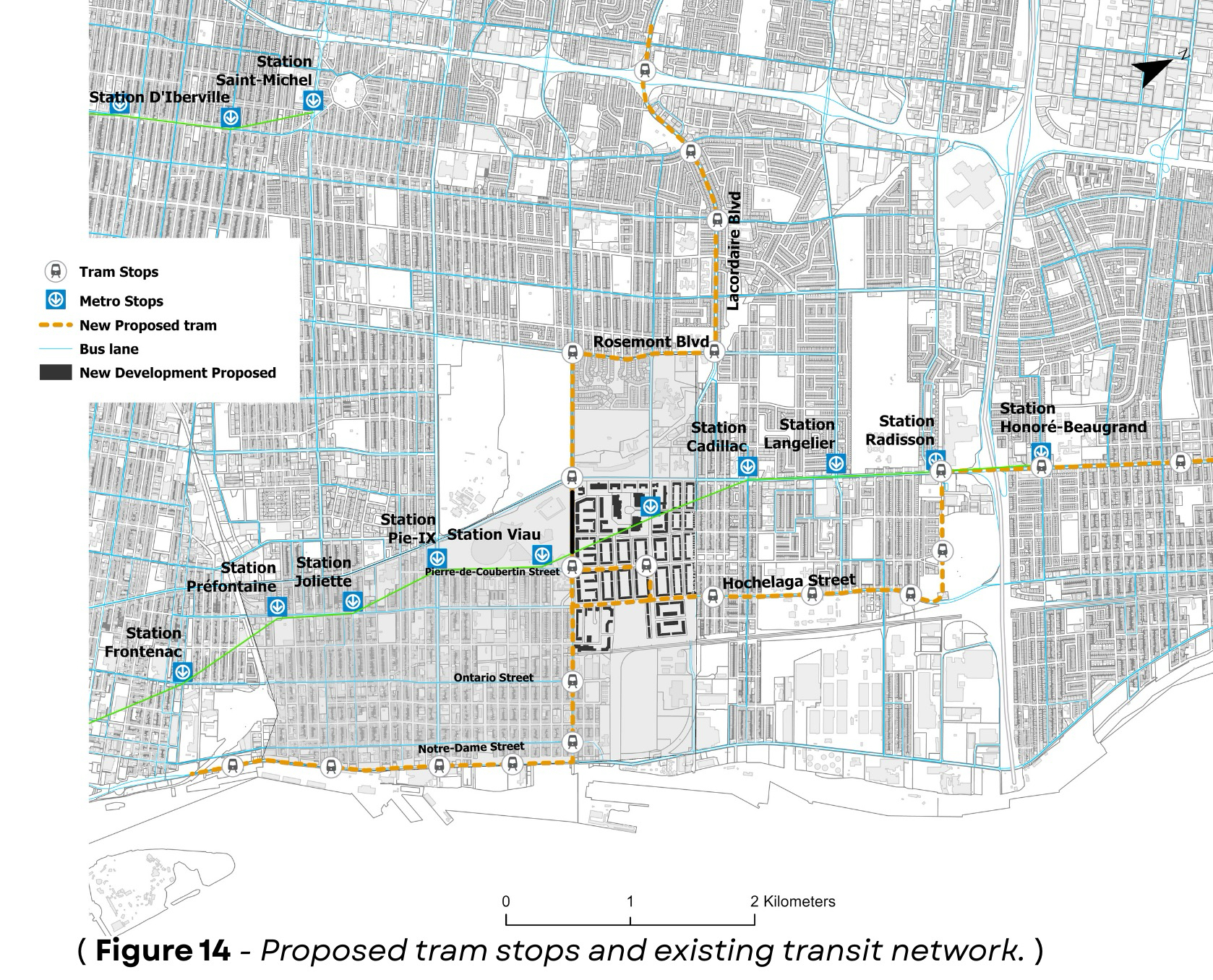
Transit Analysis
Step by step comparison of the existing transit landscape, the city rejected alignment, and the proposed alternative.
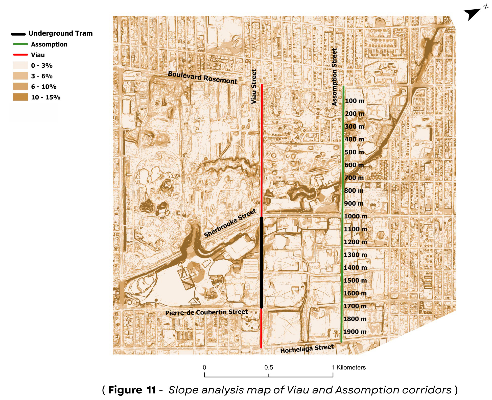
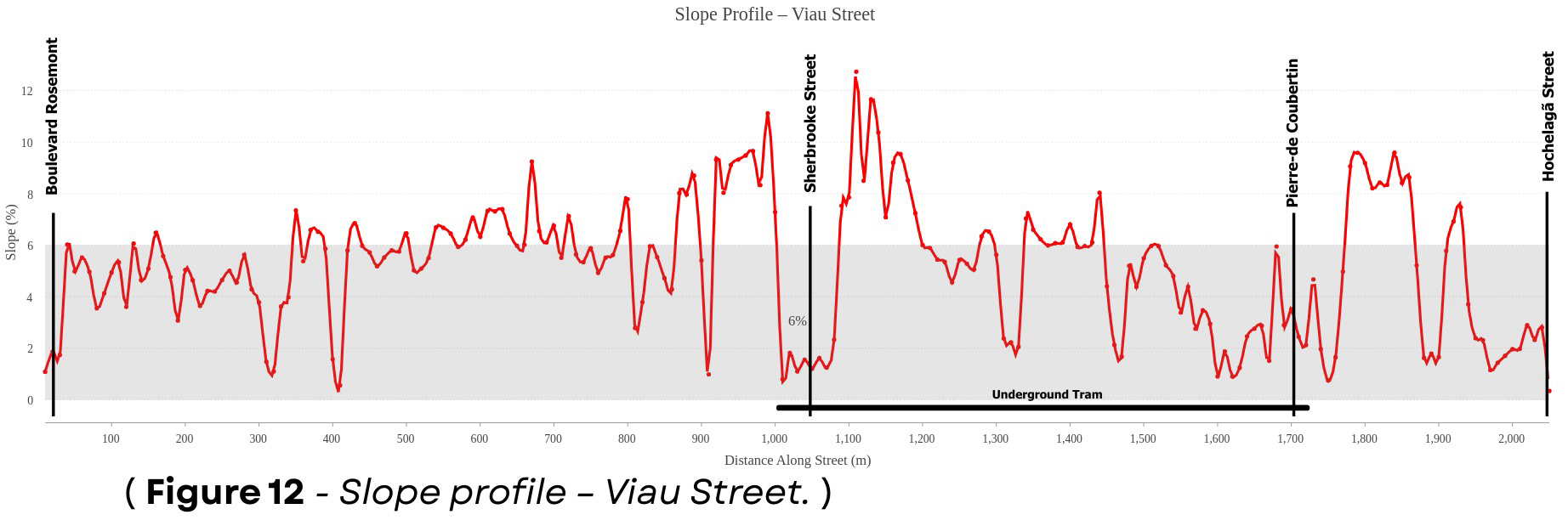
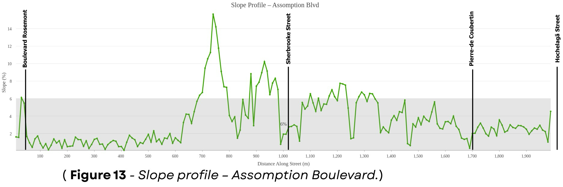
Slope Profile Summary
Slope feasibility comparison of Assomption Blvd and Viau Street for tram alignment design.
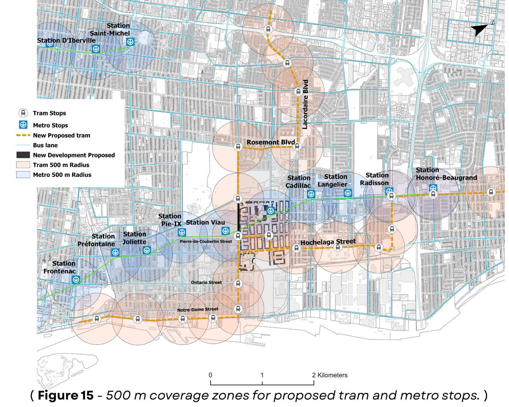
Stop Access and Coverage
-
Proposed tram stops are spaced about 800 meters apart to balance accessibility and efficiency.
-
The spacing avoids overlap with existing metro service and reflects best practices in tram design.
-
Stops are placed at key intersections and redevelopment zones to support network integration.
-
A 500-meter buffer analysis shows the tram extends access beyond the STM Green Line’s walking radius.
-
It improves coverage, especially in the southern parts of the neighbourhood.
-
The new stops complement existing bus routes, enhancing accessibility without replacing current services.
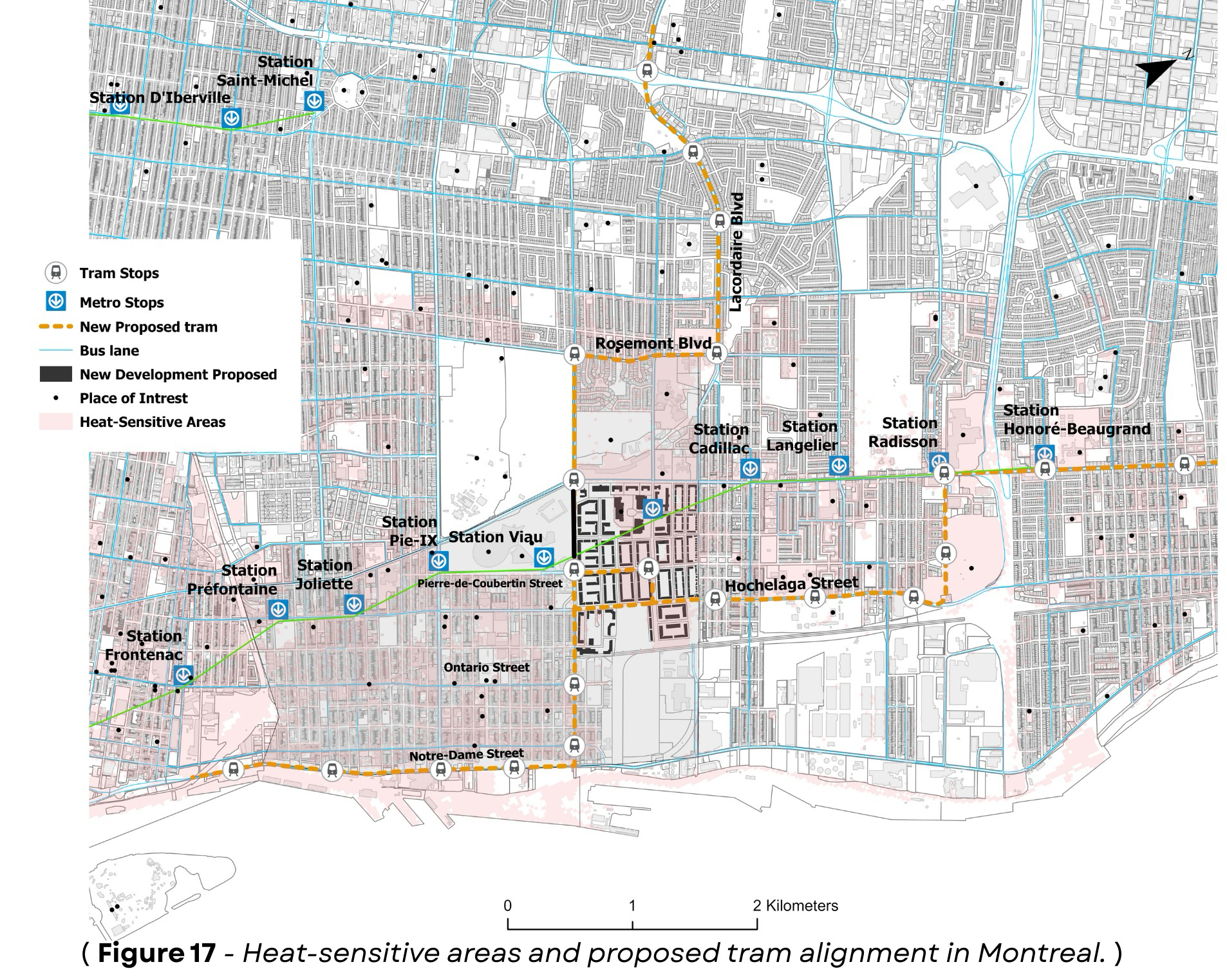
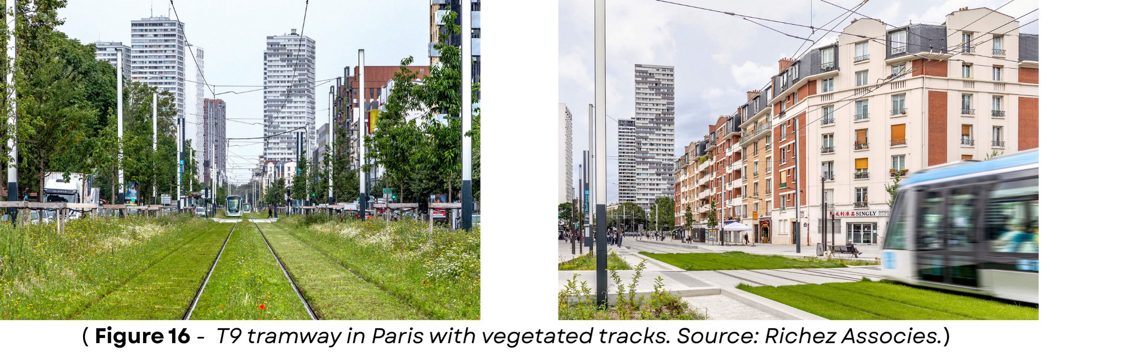
Sustainable Mobility Strategy
-
The tram alignment crosses zones identified as vulnerable to extreme heat, based on climate sensitivity data.
-
These areas are often far from metro access, densely built, or located on underused industrial land.
-
To address this, the design includes green tracks—vegetated corridors that reduce heat and manage stormwater.
-
Inspired by Paris’s T9 tramway, this approach adapts infrastructure to climate challenges while improving access to key community services.
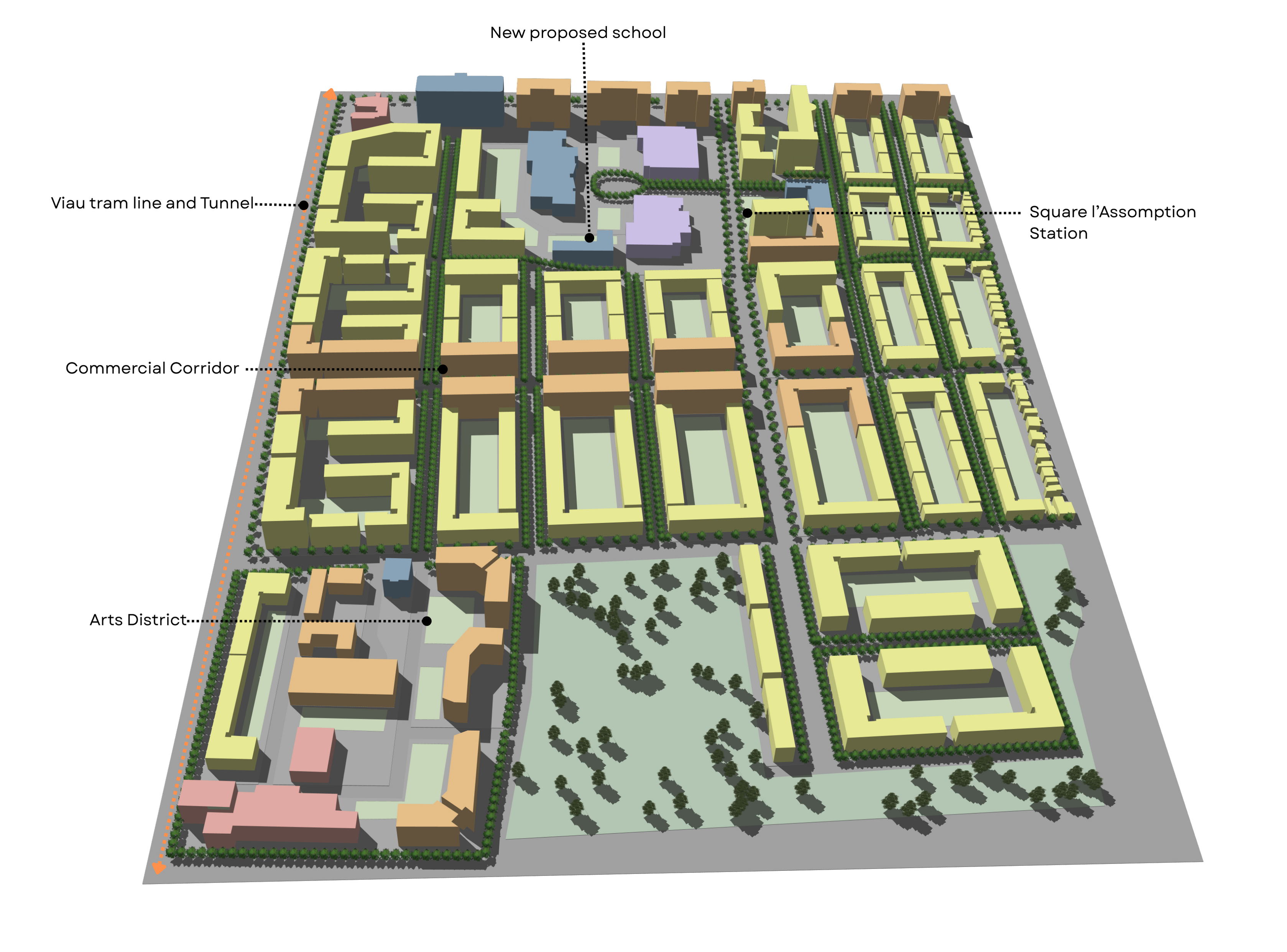
New Development Proposal
Step by step development concept showing the 3D massing, proposed plots and green spaces, and the street framework.
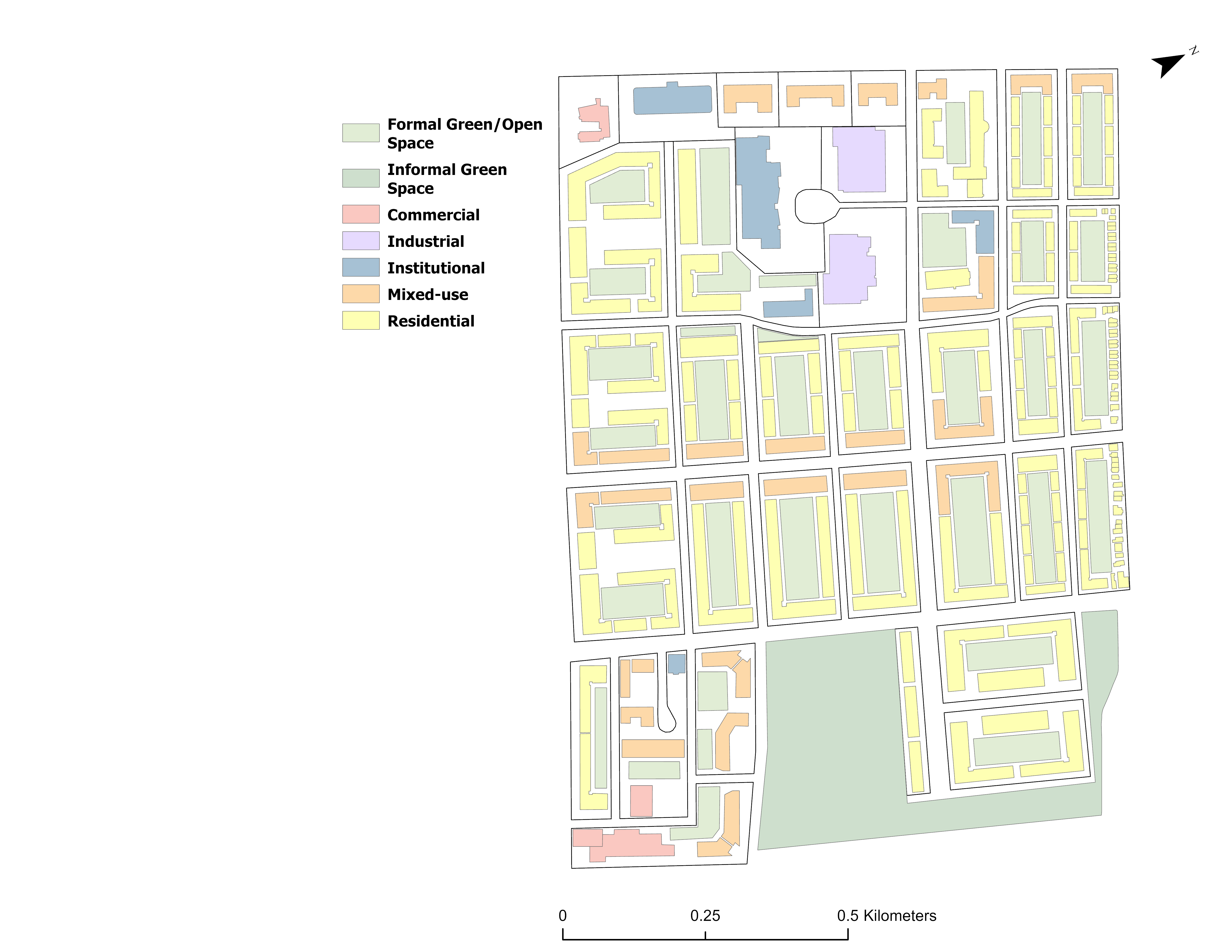
Land Use
-
The land use plan promotes a mix of functions for better integration with the surrounding urban fabric.
-
Residential use dominates, but key commercial and institutional areas enhance functionality.
-
A new commercial corridor along Rue Pierre-de-Coubertin connects to the tram line and shared street, boosting accessibility and vibrancy.
-
Industrial and institutional uses are concentrated in the north to reduce noise near residential zones.
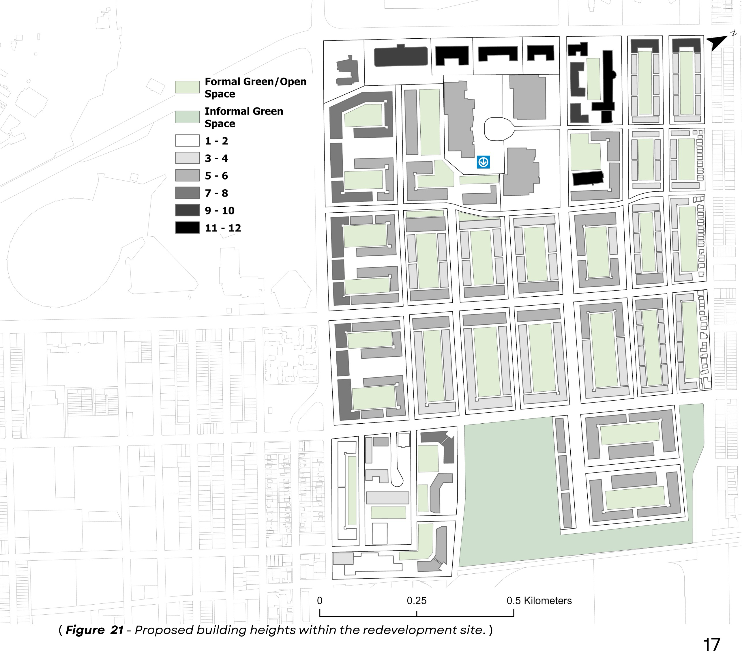
Building Heights
-
Building heights range from 3–4 storeys (residential) to 5–6 storeys (mixed-use), with 11–12 storey buildings at the edges near green spaces.
-
Taller buildings are placed strategically to take advantage of views of the golf course and Olympic Complex.
-
The redevelopment includes 12,574 new dwellings, with a projected population of 31,220.
-
Land use mix: 64% residential, 21% mixed-use, 7% institutional, 5% industrial, 3% commercial—supporting density and functional diversity.